It's good that my students have been a little distracted by our continent study. I have been so excited about creating these continent boxes! I wish I had an unlimited budget, because I'd have it crammed full of things. As it is, our local education foundation is sponsoring a grant, so I think I might get my wishlist in order and apply!
What I have so far are a few things I've already collected, as well as a trip to Michael's and Barnes&Noble. The animals are from Safari Ltd. "Toobs" or from Schleich (more expensive, I know!) and the books are from B&N. The labels are ones I've had from Dollar Tree and the larger laminated poster back there is from a Postcards Around the World bulletin board set I've had for years but can't seem to find the manufacturer (sorry). The boxes were a great deal at Walmart and are the 15 quart size.
I would really like to add the "Rookie Readers" Geography series - I LOVE those books! They get right to the point and although small, have great photos as well (I usually stick them under the document camera to read to the class). That's on my wishlist. :)
So, I created my own! All the pictures are from either Microsoft or from public domain. The clipart for the continents are from "Clip Art by Carrie" who has a great pack called "My World Doodles." They're written on a 2nd-4th grade level. (There's a 21-page preview of a few pages from each book on TpT if you'd like to check it out!).
Then, in my search for printable books, I found this.
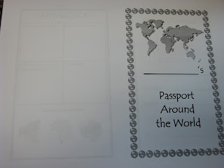
It's a passport to each continent. How cute is that? Best part? It was a FREEBIE! It was so great to share the boxes, watch a video or two from the wiki page about the continent, read the book together and then fill out where they had been in their passports! Saved me a LOT of time! I love stumbling into things like this. :) Please be sure to check out the seller's shop "Teacher E."
Another thing I do every year to help students practice locating places is create a placemat/poster for them to take home and use. This year, I decided instead of me making 21 of them, it would mean more to my kids (and good practice) for THEM to create the map! Here's my sample (ignore how large the labels are. After I put my sample together, I made them smaller so they wouldn't crowd up the map!). If you teach SOL 2.5 (VA), it has all the components, plus the Native American regions. If you teach outside VA, it's also good practice!
I can't thank bloggers out there enough for sharing their ideas! I found a TON of links from Pinterest and found that these continent boxes are Montessori-based, and found too many to mention freebies of photos. It's on my Geography Pinterest page if you'd like to check it out.
So, they're calling for storms so I guess I'd best be heading out of here and to the safety of home! Click on any of the pictures to learn more about our "Trip Around the World!"


0 comments:
Post a Comment